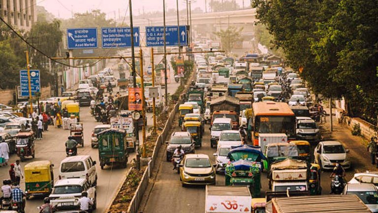
In a major push to untangle some of the capital’s most notorious traffic snarls, the Delhi government’s Public Works Department (PWD) has initiated a comprehensive plan to develop eight key stretches across the city. The project, which covers nearly 47 kilometres, will see consultants prepare detailed feasibility studies for flyovers, underpasses and elevated corridors.
As reported by TOI, the initiative forms part of an integrated transit corridor development plan. Each proposed corridor has been meticulously mapped, with officials identifying traffic signal counts, available right of way (ROW) and the root causes of congestion. The primary aim is to resolve chronic bottlenecks and improve connectivity on stretches that serve as vital commuter and freight routes.
The plan targets several high-impact areas. One of the most significant is a 7-kilometre stretch of Deshbandhu Gupta Road, from opposite Paharganj up to Ajmeri Gate. Currently plagued by nearly seven traffic signals, the road suffers from severe congestion throughout the day, prompting the feasibility study for a flyover or underpass.
The bustling ITO intersection, one of Delhi’s busiest nodes due to its high concentration of government offices and media houses, is slated for a 4-kilometre integrated corridor. This stretch, encompassing Vikas Marg, Deendayal Upadhyaya Marg and Bahadur Shah Zafar Marg, is slowed by approximately five signals, TOI reported.
On the city’s eastern edge, the plan envisions a 6-kilometre elevated corridor from Nanaksar Gurdwara T-point to the Delhi-UP border at Tronica City. However, this stretch presents significant challenges, including environmental restrictions related to the Yamuna floodplain, numerous trees and utility obstacles like Delhi Jal Board pipelines.
In a move to improve access to the aviation hub, the busy NSG intersection in front of Terminal 1 of the Indira Gandhi International Airport has been shortlisted for a 2-kilometre flyover or underpass to decongest its four-arm junction.
Further afield, an ambitious 20-kilometre redevelopment is planned from Najafgarh (Phirni Road) to NH-48 near Kapashera. This corridor, which includes a section of the Old Delhi-Gurgaon Road, features 15 traffic signals and areas of severe congestion, particularly at Samalkha village and Kapashera Crossing.
According to the TOI report, the consultant’s role will be extensive. Beyond standard traffic and origin-destination surveys, they will be required to map land ownership, assess encroachments and prepare layouts for potential land acquisition. A GPS-based tree census will also be conducted in consultation with the forest department to plan for transplantation or felling.
The detailed project reports must cover design, cost estimates, economic viability and necessary approvals from a multitude of bodies, including UTTIPEC, the Delhi Urban Arts Committee, the Archaeological Survey of India and the forest department. The scope of work mandates a strong focus on pedestrian safety, including kerb ramps and footbridges, utility ducts, stormwater drainage and road safety audits aligned with Indian Road Congress norms.
Environmental safeguards such as noise barriers and ecological studies, alongside a baseline socio-economic survey to minimise displacement, will be integral to the planning process, ensuring the projects are sustainable and socially responsible.


